Climbing Mount Ossa
Elevation: 1,617 metres Nearest towns: Mole Creek or via The Overland Track or Arm River Track
Difficulty: Medium/Hard Date[s] climbed: 29/05/2008 05/01/2011 25/01/2011 Location: Tasmania Authors: Brian and Graeme
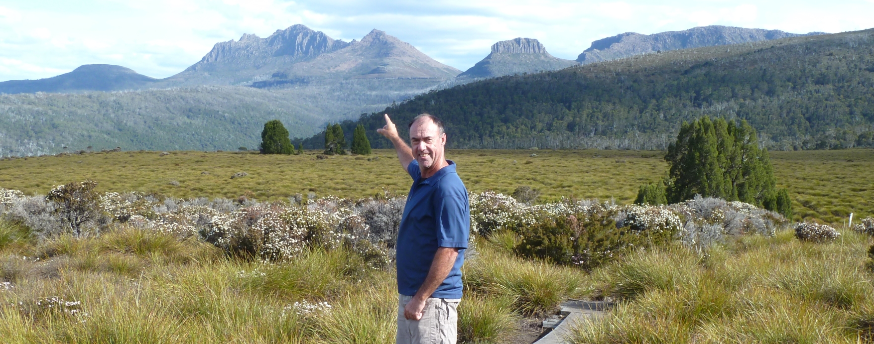
Mount Ossa is buried deep in the heart of the Tasmanian Overland Track and is Tasmania’s highest peak. It was my second State 8 climb which I did solo. Graeme took Ossa on as part of the Overland Track with my son Kadison. Tanya and I followed that up by climbing Ossa some weeks later whilst on the Overland Track also.
Warnings.
The same old warnings for climbing in high alpine areas. The vagaries of weather means you need to be prepared for all weather conditions. Climbing in summer is recommended.
History
The Mount Ossa name appeared on an 1860s map by geologist Charles Gould, following George Frankland's theme of applying classical Greek names. However, Gould showed Mt Ossa where the much lower Mount Nereus is located today. Jorgen Jorgensen (an early ex-convict) had variously called it Parsons Hood and Mount Dundas. Both of those names have since been ascribed to other mountains. John Beattie (the colony’s official photograph of the time) added to the confusion by calling it Mount Backhouse. As late as a 1901 geological sketch, four of the major peaks of the Pelion Range were numbered rather than named. (Info courtesy of the University of Tasmania)
Mt Ossa, and its standing as Tasmania’s highest mountain, was formally ratified in 1954.
The Climbs
Brian – 2009
This section describes the first summit of Ossa by me via the Arm River track.
Ossa is normally climbed as a side climb via the Overland Track walk. Given time limitations I identified an alternate approach by coming in through the Arm River track and my aim is to solo climb Ossa in one long day. Typically, 40 odd km's round trip. To ensure I don't waste time Tanya and I drive out via the Arm River Track Road from Lemonthyme Lodge the day before and ID the route there and the start. It's reasonably easy to find.
Leaving Lemonthyme at 4:20 AM I'm ready to kick off at 5:40 and tentatively make my way from the car park (3 or 4 spaces only), up the track which is nearly hidden by the rivulet that shares the track. You soon break out into the track proper and whilst very steep, it's easily followed until it meets the Overland Track proper some hours later. I'm carrying a big pack as I may have to overnight if the weather is bad, however I'm blessed with good weather and make good time. Getting up to the plateau is hard work but once there it's fairly easy going. It's magnificent country and the wow factor is ever constant. Mount Oakleigh and Lake Ayr sculpt a magnificent gateway to Pelion Hut; I haven't seen a soul and the isolation heightens my already heady outlook.
Pelion Hut is really well set up; I take a short break and use their fabulous drop dunny but am less than encouraged by the "as long as it takes" reply to my query on the time to Ossa and back! Pelion Gap is soon reached in spite of having to forge past all the Overland trackers who are slowly wending their way uphill. There is a good place to dump your excess gear whilst you do the Ossa return climb, however I'm reluctant to do that, but should have in hindsight. It's hard to discern the actual peak of Ossa as I head up the side of Mount Doris, a stepping stone to the "real" climb up Ossa.
It's steady going however the wind is blowing a gale and it's cold. Then it's nearly straight up the steep east face of Ossa amid much scrambling over large rocks. In places thigh deep drifts of old snow mask the gaps between rocks, however previous climbers have left tell-tale footprints and soon the summit is reached. I'm in luck, a clear blue sky reveals and complements the magic 360-degree panorama that unfolds and I try to capture the vista with my camera. Other climbers are only too willing to take reciprocal, "I made it" photos and after a quick drink and snack I reluctantly leave the bitterly cold summit for the long trek back.
Pelion Hut provides a symbolic break point for a muffin, then it's first gear and a steady tramp back to Arm River. The return is punctuated by three encounters with climbers heading in to Pelion Hut and I am grateful for the brief "G'days" and light exchanges. The return is much easier than outward bound however I'm weary and the track back seems much longer. The car comes into view and I'm ready to tackle the 80 km drive back to the Lodge. All up, door to door, has taken 15 hours and it's fantastic to get back to my wife, shower and much needed food.
Climbing Ossa via the Arm River track is an outstanding walk. In spite of the climb being incident free I do however resolve ( Love you Tanya) not to undertake a major solo climb again given the isolation and potential for something going amiss. It has been an arduous walk and I have rated it hard not because of the climb difficulty but the very long day. From New Pelion Huts or as a side walk it is a medium difficulty climb.
Of the State 8, Ossa is one of my favourite climbs given the endless beauty of the area.
Graeme – 2011
As Brian had previously climbed Ossa, we decided for my climb to attempt it via the Overland Track. As camping for 6 days lost its appeal when I passed my first half century, we went with "Cradle Mountain Huts". Wonderful, hot showers, good huts, and great guides and company. We started on Jan 3, but unfortunately Brian and Tanya had to postpone at the last minute which left me and their son Kadison for the walk. We began at Waldheim in beautiful sunny weather.
The Ossa climb is on day 4 of the walk, and by this time I was driving everyone nuts worrying about the weather conditions for the climb. I did not need to worry as Ossa day was magnificent, blue skies and no wind. We made good time from Pelion hut and left some of our gear at Pelion Gap. Five of our group, myself, Kad, Graham, Cassandra and Paul, attempt the climb, ably led by Ben, the Cradle Huts guide (or mountain goat).
We make excellent time as the conditions are so favourable and the summit is reached in under 2 hours. My elation to summit the "last" of my 8 was only tempered by the absence of Brian, who began our quest. However, I knew that he would be here 2 weeks later to add Ossa to his now State 11! (Bimberi, Woodroffe and Ossa twice!) Photos and celebrations ensued, and lunch at the summit.
Ossa is a magnificent climb and enhanced by the incredible experience of walking the Overland track. Just do it! The track should also be a prerequisite for anyone wishing to enter parliament in Australia! My thanks to Ben and Ciara from Cradle Mt huts for their friendship and good humour, and to my walking companions, especially Kado. What a great journey the "State 8" has been.
Brian – 2011
Due to the recent death of my Mum, Tanya and I were unable to do the original Overland Track with Graeme and Kadison in early January and we took it on some 3 weeks later. I’m sure my Mum travelled with us in spirit.
We kicked off our guided tour from Quamby Estate, (a fabulous history ingrained location) with another 6 intrepid walkers. We were lucky to have 3 guides, as one of our companions, a German named Martin, elected to go pack free. As it turned out that enabled me to do a quick side climb of Cradle Mountain with one guide and a couple of the group. (Do it, it’s a fabulous area and climb – Tanya and I and the kids also climbed Cradle on another occasion) I also climbed Mount Oakleigh which is equally magnificent.
I won’t describe the Overland Track experience other than to reiterate Graeme’s comments. It’s an amazing place and experience. Do it with your children (grandchildren) when they are old enough!
It’s Ossa summit day and Tan and I head off with our fellow walkers to the Ossa trailhead. Tan has had trouble with an Achilles heel problem and is feeling the pinch. She is determined to pull it off. It’s a slow uphill trudge to the start, but we are warmed up and ready to go. Excess baggage dumped, all eight of us head off, with glorious weather encouragement.
Halfway up, one of our group, a not so fit middle-aged Mum, cramps up and we are entertained by her being placed on her back on the side of the mountain, by one of the female guides and having her legs pumped back into life. (Martin looks very uncomfortable) So funny to watch. Quite recovered we push on to the summit where the group undertakes a spontaneous “Shake it, Shake it, Baby” dance. (I was the photographer) which was hilarious. Tanya did the climb on her ear!
The view from the summit is magnificent and an intoxicating acknowledgement that we are on the roof of Tasmania. Shake it Baby!
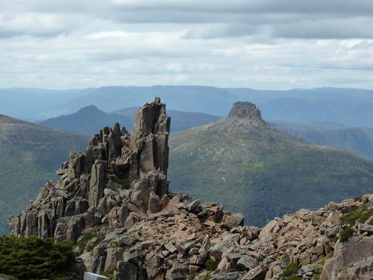
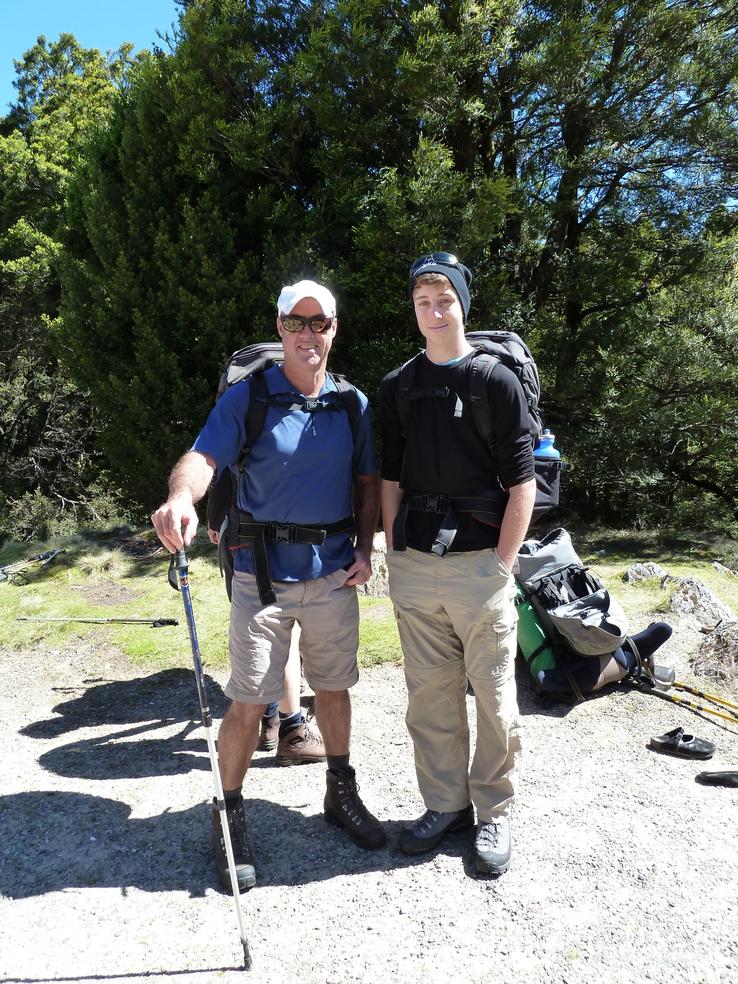
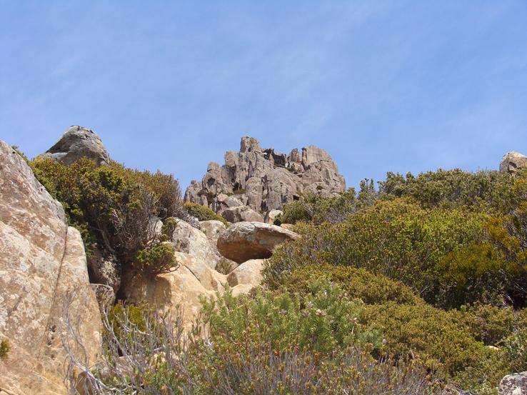
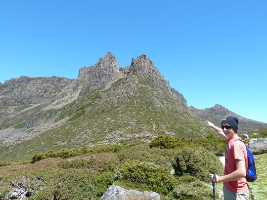
Mount Ossa - Click on an image for full resolution



Climbing Legges Tor
Elevation: 1,572 metres Nearest towns: Upper Blessington
Difficulty: Easy Date[s] climbed: 25/02/2018 and 11/12/2009 Location: Tasmania Author: Graeme

Legges Tor is the summit of the Ben Lomond range, in North East Tasmania, and is the second highest point in Tasmania behind Mt Ossa. Brian and I “climbed” at different times, as we counted Legges Peak as a “need to do” climb rather than one needing serious planning.
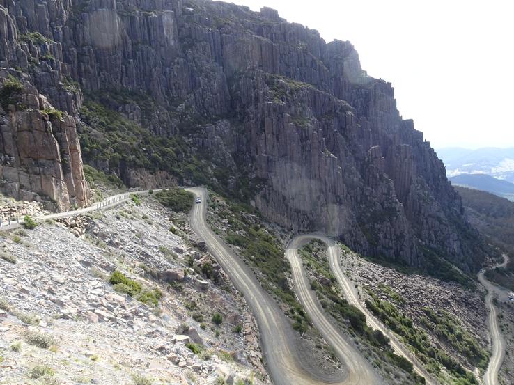
Tasmania is always a remarkable place to explore, and for this one, we did separate trips with our wives. While the climb is as easy as you wish to make it (the road goes almost to the top), the surrounding scenery and quaint Tasmanian towns make the trip to Legges Tor a memorable one. Be aware, if you have a problem with heights, you may not even summit the access road, and up a local feature called “Jacobs Ladder”. Brian took some impressive photos. Cate and I drove up in a white-out, and staying on the road was near impossible. However, at least we could not see the drop off!
History
Legges Tor was originally named “Legges Peak” in a paper to the Royal Society of Tasmania, after a survey by Giblin et al. It was named after William Vincent Legge, soldier and scientist. Legge was born in 1841 in Cullenswood in Van Diemens Land (not renamed Tasmania until 1856), son of an Irish immigrant and landowner. He was sent as a child to England, and was educated at Bath, and also spent time in France and Germany. In 1862 he received his commission into the Royal artillery, and was posted to Ceylon. He developed a keen interest in natural history, and even published a book on birds in Ceylon, before being posted back to England as an instructor in gunnery, (poor birds of Ceylon). From there he was appointed to command the forces in Tasmania, where he re-organised the defence batteries around Hobart. He was also a fellow of the geographic society and vice president of the Royal Society of Tasmania. As such, he was instrumental in the mapping of the Ben Lomond Range, and in 1967 the highest point was named “Legges Tor“ in his honour. He also has a bird of prey named after him, “Legges Hawk-eagle” which is found in Sri Lanka. Legges was certainly a high-flyer!
Warnings
Tasmania, and Legges Tor is a dangerous trip, only for the fact you may not wish to return home. Travel with family or friends, and enjoy. Tasmania is one of the few places left which has not been totally spoiled. A must is a visit to Evandale, en route to Legges Tor. Friendly people, and serious antiques.
The Climbs
Graeme
As previously mentioned, Brian and I did separate climbs.
Cate and I climbed on 11/12/2019. We based ourselves in Launceston, and drove out via Evandale. The route is easy to follow. Just find Ben Lomond Road, and it takes you all the way to Ben Lomond Ski resort, which is about 500 metres from the summit of Legges Tor. There is a sign and pathway to the summit on the right before the ski village. Or you can park at the village and amble up the slope. If you wish for a longer day walk, the circuit from Carr Villa hut would be more suitable.
Legges Tor itself is not that impressive, but the surrounds are vintage Tassie. We drive via Evandale, and stop at the antique shops. Then on to Ben Lomond Road, and as we approach Ben Lomond National Park, the weather closes in. Jacobs Ladder is an impressive piece of road engineering, zig zagging back and forth up precipitous slopes, through impossible hairpins overhanging vertical drops. We see none of it, as visibility is about 10 feet! Possibly a blessing if you’re not happy with heights. The conditions are not suitable for the Carr Villa circuit, so, we drive all the way to the Ben Lomond Ski Village, and then retrace our steps back to a sign before the Village which points to “Legges Tor”. A misty 30 minutes later and the summit is attained. And then back to those antiques!
Brian
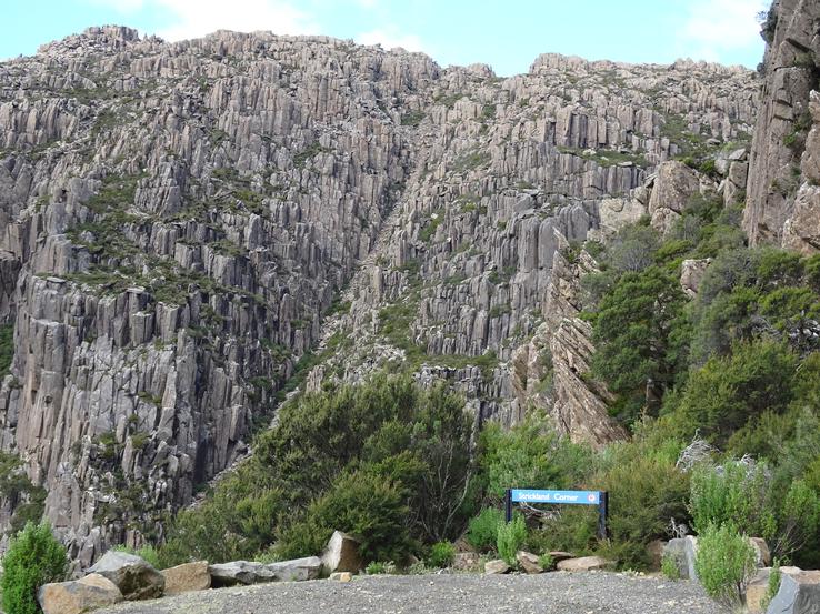
Tanya and I climbed Legges Tor in February 2018. A perfect time to visit the Apple Isle. Unlike Graeme and Cate, we were blessed with gorgeous weather and got to enjoy the full vistas Ben Lomond National Park has to offer. We stop and take pictures on every “named” corner of Jacobs Ladder, plus there are a couple of great viewing platforms at the top of that section of road.
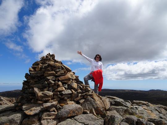
We park next to the sign indicating the Legges Tor trailhead and casually walk up through gorgeous alpine trails, there being no trees to mention. Towards the summit that growth gives way to the usual boulders and we are soon at the cairn. Fantastic views.
Whilst the climb to Legges Tor is both short and easy, it’s a largely unspoilt wander through a classic alpine area, with Jacobs Ladder adding a short Dakar like element to the experience and rock formations that are both unique and hugely imposing.
Legges Tor is most definitely worth a visit.
Legges Tor - Click on an image for full resolution


